Category: Places

Saving Nature In China

November 20, 2018

by Stuart Pimm

Saving Nature in China

I’ve just spent three weeks in China — my second visit this year. It’s part of an overall commitment to conserving China’s biodiversity that now accounts for a month to six weeks every year of my time.

Why China?

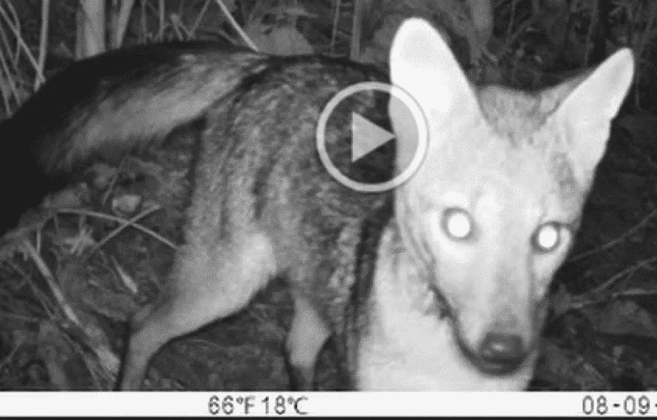
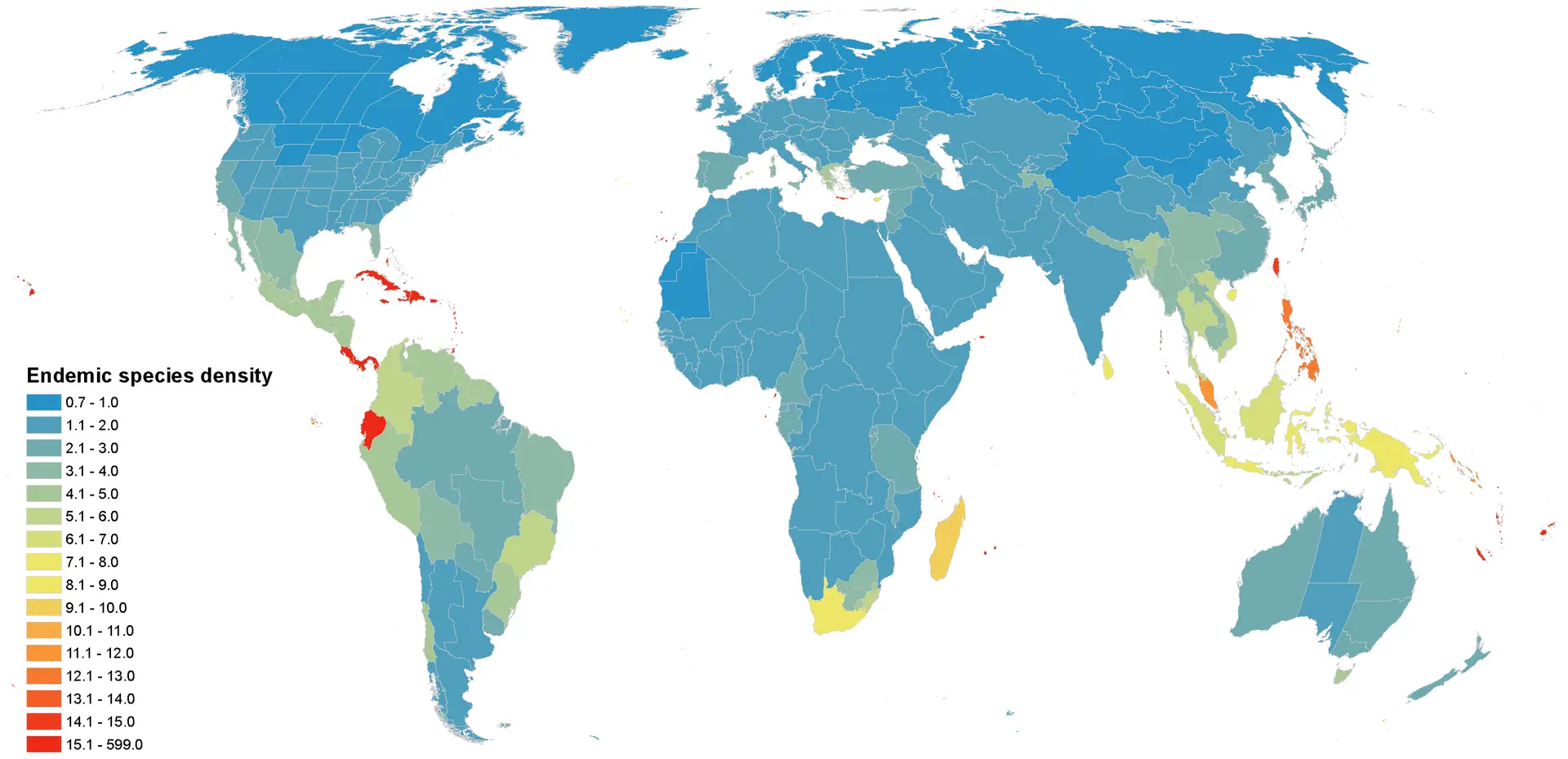
Well, in large part it’s because China is so important for its exceptional biodiversity. China holds 15% of the world’s vertebrate and 12% of its plant species. Its ecosystems range from permanent ice fields to tropical moist forests. Importantly, it is becoming an international leader.

The International Convention of Biological Diversity’s Aichi targets specify quantitative targets for areas protected (target 11), stopping loss of natural habitats (target 5), and the extinction of threatened species (target 12), while underscoring the vital importance of the ecosystem services natural ecosystems provide (target 14). In 2020, China will host the Convention’s 15th Conference of Parties. Under President Xi, improving the environment has become a national priority.

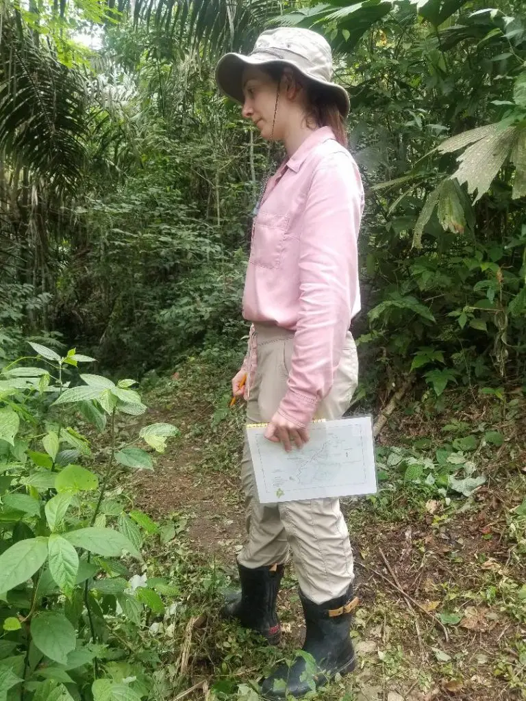
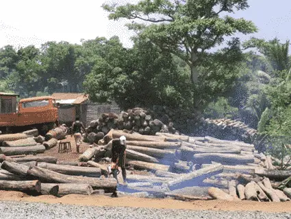
China is also looking outward, to developing infrastructure across Asia and particularly Southeast Asia. One of my reasons for being in China was to attend a conference, organised in part by Professor Binbin Li, a former Ph.D student of mine and now an assistant professor at Duke University Kunshan.

Binbin and I have published key papers on identifying which areas of China are important for biodiversity. In particular, we have examined to what extent protecting giant pandas protects other species and also what places are important for species across Southeast Asia (Saving Nature Vice President, Dr. Clinton Jenkins, was a co-author of the latter paper, too.) There’s a lot we can do as conservation professionals to help our Chinese colleagues. I have seven papers in giant pandas (and many others on other issues) because I’ve been able to help with analyses and structuring conservation work using skills and experiences I’ve developed elsewhere.

Is there an Important Role for Saving Nature in All This?

Well, yes, but it’s a distant vision. The Saving Nature model helps local conservation groups buy and restore land to reconnect isolated landscapes. We take this approach because almost all the key places for threatened species are in fragmented landscapes. It’s a niche, of course, but one we fill very successfully. We can’t buy land in China, but the model of reconnecting habitat fragments applies there as is does elsewhere. So, we’re talking with our Professor Li and other colleagues about how to apply our approaches there.

Finally, mitigating the effects of the infrastructure projects of the Belt and Road Initiative will require understanding where these projects intersect key areas for biodiversity. Identifying them — and looking for ways to minimise their harm to biodiversity— has to be a first step. So, no, we aren’t building habitat corridors in China yet. But keep watching this space.

Lessons in Camera Trapping

Camera Trap photo fo Crab Eating Fox

October 26, 2018

by Bridgette Keane

LESSONS IN CAMERA TRAPPING

As a student at Duke University, I worked with Dr. Stuart Pimm during the spring to plan a trip to monitor protected areas in Ecuador and Colombia that his organization is working to connect and restore. As part of the “camera trap team,” I spent a semester familiarizing myself with the use of camera traps for conservation work. This involved skimming dozens of scientific articles and reviewing different camera trap models from outdoor retail websites.

Once I arrived in the field, I realized that you can only learn so much from websites and articles. I was lucky to have received advice from Dr. Jim Sanderson about how to set-up camera traps. His guidance helped reduce the amount of troubleshooting we needed to conduct in the field.

We visited two project locations, starting with the Jama Coaque Reserve, run by the Third Millennium Alliance. We then travelled to La Mesenia in the Colombian Western Andes, run the The Hummingbird Conservancy for our second installation.

Camera Trap photo fo Crab Eating Fox
Bridgette Keane Camera Trapping
Bridgette Keane considers camera trap settings

Navigating the Owner’s Manual

We spent the first few days at Jama Coaque placing traps on nearby trails to evaluate various camera settings. Basic recording options included pictures, videos, or both – but there was so much more to consider. 

Other settings included image/video format and size, LED control (how many LEDs you want to go o for night images), motion sensor level (how sensitive you want the sensor to be set to), and the time interval between pictures (how long you want the camera to wait before it takes another picture/video if it is being triggered many times in a row).

Setting Our Traps

Once we actually started positioning cameras in the field, I quickly discovered that there was much more to think about than just the camera settings, as Jim Sanderson had warned me. First of all, I was not familiar with the reserve. I came in with an idea of a placement pattern for monitoring the corridor. Once there, I realized that placing the traps depended much more on the trails and in some cases, security issues.


I had to do my best to crawl my way through game trails, scouting locations in the path of animals, but away from people. I carried a machete to clear any vines or branches along the trails near the camera. Anything moving in the wind in front of the camera may inadvertently trigger it.

Finding the right spot was just one of the many challenges to placing camera traps. My days in the field usually involved hiking for hours up steep hillsides to a predetermined GPS location. Once there, I spent another hour finding the right tree, clearing the area, and positioning the camera. (Picture me jamming sticks behind it to get the perfect angle and checking the line of sight by squatting in front of it, resulting in some wonderful photos).

Unexpected Discoveries

As we learned the in’s and out’s of camera trapping, we start rethinking the technology’s possibilities. In the short-term we simply wanted to understand what species are using wildlife corridors in various stages of renewal. For the Jama Coaque Reserve, it was especially important to monitor areas of forest that were newly restored. 

We were beyond thrilled to find ample movement of various species through very young forest in just the two weeks that we spent at the site. The most surprising and exciting discovery was a video of an ocelot moving through forest that was open cattle pasture just a few years ago.

Our two week stay at the reserve at La Mesenia, Colombia was even more challenging from a terrain perspective. The hikes were steeper, longer, and much more treacherous. They often took an entire day and needed to be planned out with and led by one of the reserve’s local rangers. In the short time we had at the reserve, it was simply too difficult to check them. However, our partners will be checking the cameras regularly to make sure they are running properly and will hopefully find some quality videos!


A View From the Canopy

For long-term research, the camera trapping project in Jama Coaque will next extend into the canopy. The idea is to record pictures and videos of animals that rarely come down to the ground. The research team will also pair each canopy trap with one on the ground. This protocol for corridor monitoring transcends the typical limits of camera traps by expanding camera placement to include a vertical dimension. As a result, we’ll have a more complete picture of how the entire forest is being used.


Ongoing Research

The team in La Mesenia is also shaping a long-term plan to monitor species moving through the corridor. As we collect date over the long-term, we will better understand what species use the corridors as they mature. These insights will help conservation scientists understand how to best reverse the dynamics of forest fragmentation and help species have access to the resources they need.

Please support our research into the science of wildlife corridors and species recovery.  Your support helps mentor young scientists.

Protecting 20% of Land to Save Two-Thirds of Plant Species

September 5, 2013

You’ve heard the adage, “If it sounds too good to be true, it probably is.” But new research by Saving Nature scientists offers an amazing conservation ‘deal’. Backed up by top-flight science and data, it’s too good to pass up. So what is the deal? The new paper, published today in Science, was co-authored by Saving Nature founder Stuart Pimm and Vice President Clinton Jenkins, and by Lucas Joppa of Microsoft Research, who completed his Ph.D. with Pimm. 

PROTECTING A FIFTH OF THE WORLD'S LAND TO SAVE TWO-THIRDS OF ALL PLANT SPECIES

The key finding of the paper is that protecting a fifth of the world’s land area will save two-thirds of the world’s endemic plant species. Using the Kew Gardens plant database, the authors looked at the geographical distributions of 110,000 plant species. From this analysis, the researchers identified the smallest set of regions that contain the largest number of plant species.

They discovered that nearly two-thirds of the world’s plants occur in just 17 percent of the world’s land. The bad news is that less than a sixth of that 17 percent is currently protected. “Our study identifies regions of importance. The logical – and very challenging – next step will be to make tactical local decisions within those regions to secure the most critical land for conservation.” Pimm said.

Map by Clinton Jenkins illustrates endemic plant density is concentrated in only 17% of the planet’s land area.

Incorporating years of data, Jenkins created a detailed, color-coded map of Earth. The map illustrates where endemic plants are concentrated. This information helps conservation ecologists, policy makers, and economists to prioritize locations for conservation eorts. Because of ecological food webs, protecting endemic plants not only helps save rare plant species—it helps save dependent species, such as specialist herbivores, epiphytes and so on. “We also mapped small-ranged birds, mammals and amphibians, and found that they are broadly in the same places we show to be priorities for plants,” said Jenkins. “So preserving these lands for plants will benefit many animals, too,” he said.

According to Pimm, to achieve biodiversity conservation goals, the world needs to protect more land than we currently do and much more in key places such as Madagascar, Colombia, and coastal Brazil. These are all places where Saving Nature works. 

Saving Nature relies on cutting-edge science to make its conservation decisions. With the limited amount of conservation funding available, we must use the best science to maximize the number of threatened species of wildlife and plants we can save. The report’s findings truly oer conservationists a great deal.

SCIENTIFIC NOTE: The work in Science focused on endemic species of plants. Endemic species exist only in specific places, such as a particular mountain range or forest. Endemic species are typically very rare, because of their limited geographical distribution. Endemic plants are also crucial to ecosystems that support other endangered species and, more broadly, biodiversity. Because they exist only in one place, endemic plants are often hosts for other endemic species that depend on them—insects, animals, and even other plants such as epiphytes.

Data Shows Limited Recovery for Hawaiian Sea Turtle

Two green turtles basking. Courtesy Mark Sully, NOAA/NMFS Hawaii Monk Seal Research Program. Papahānaumokuākea Marine National Monument.

May 26, 2013

By Stuart Pimm

Historical Data Suggests Hawaiian Sea Turtle Recovery is Limited

Hawaii is famous for its tranquil beaches, surfing, and for pairing pineapple with pizza. But it is Hawaii’s green sea turtles that are one of the most popular tourist draws today. 

Hundreds of thousands of tourists trek to Oahu’s North Shore every year to see these creatures haul out of the ocean to bask on the sand under the tropical sun. 

The turtles seem so numerous today it is easy to forget that only a few decades ago most feared their extinction. The population had been harvested for food – like fish – by local residents and for a commercial fishery that targeted turtles. All harvests were banned in 1978, however, and surveys by NOAA scientists have documented a steady increase in nesting at one rookery ever since.

As a result of this rebound, some have called for the species to be removed from federal protection, de-listed as a threatened species, and for harvests to reopen.

A new study published in the journal Ecography, however, demonstrates that 80% of the historically major nesting sites for the population are extirpated or dramatically reduced and shows how this concentrates the risks posed by climate change. 

The authors of this synthesis represented a diverse collaboration of ecologists, geographers, and historians – in what’s become known as the discipline of historical ecology.

Dr. van Houtan, an outstanding young scientist, who last year, was awarded a Presidential Early Career Award for Scientists and Engineers, by President Obama, for his work on turtles.
Green turtle and monk seal harvest on Laysan Island, unspecified date, courtesy State of Hawaii

Historical ecology is deceivingly simple.

Modern scientific data are chronologically limited, forcing scientists to look at proxies such as ice cores, sediments, or tree rings for long-term data sets. In historical ecology, researchers mine historical records for any information on the abundance, distribution, or demographics of wild populations. 

Art, restaurant menus, ethnography, newspaper articles, and naval journals have all shown to be rich sources of information for species as diverse as Atlantic cod, African rhinos – and Hawaiian sea turtles.

I think most ecologists are fascinated by the idea of historical ecology. Who wouldn’t want to travel centuries back in time and see wild nature?” said study author Dr. Kyle Van Houtan, who leads NOAA’s Marine Turtle Assessment Program, based in Honolulu. 

The question with historical observations has always been how they might be organized to inform conservation management today.” 

Gaining Insights Before Exploitation

To answer that question, Dr. Van Houtan and his team scoured historical information in a host of museums, libraries, and Internet databases like Google Books and Project Gutenberg. They were rewarded with hundreds of historical accounts of sea turtles in Hawaii.

In Hawaii today, more than 90% of the green turtles nest on a low-lying coral atoll in the remote Northwestern Hawaiian Islands. However the study found nesting was significant and widespread across Hawaii, even a major nesting area on the island of Lanai that was hunted to oblivion shortly after World War I.

This historical perspective this study provides is important then for context for the recent decades. Many species on the U.S. Endangered Species Act were listed there in the 1970s, when their populations were at all-time historical low points. 

According to Dr. Van Houtan, “the unprecedented modern population bottlenecks probably are not the basis for setting recovery targets, healthy populations are. This is where historical data are useful – to give insights before exploitation.”

Figure from the paper showing modern and historical data on green turtles.


The study appeared this week in the Early View at the journal Ecography. http://onlinelibrary.wiley.com/doi/10.1111/j.1600-0587.2013.00245.x/abstract

Oil and Gas Can Coexist with a Thriving Amazon

A tanker waits to pick up oil

May 16, 2013

by Stuart Pimm

Oil and Gas Development Does Not have to Destroy the Amazon

When one thinks of the Amazon, it is usually of lush rainforests or indigenous people living amongst a wild landscape. Certainly, that is part of the Amazon’s story, but there is more, some of which may be a surprise. There is a good chance that the Amazon also produced the gasoline that powered your car today. The vast forest holds not just biological and cultural riches, but also hydrocarbon riches. The font line of the conflict between a wilderness wonderland and the modern petrochemical age is the western Amazon, one of the most biologically and culturally diverse zones on Earth.

A Framework of Best Practices for Hydrocarbon Development in the Amazon

Now a new scientific study by NGS grantees Clinton Jenkins and Matt Finer, along with engineering expert Bill Powers of E-Tech International, proposes a 10-point framework of best-practices for hydrocarbon development in the Amazon. 

By combining advanced engineering criteria with consideration of ecological and social concerns, they present solutions for reducing the many potential impacts of hydrocarbon development.

For example, by using extended reach drilling (ERD), a technique to reach a larger subsurface area from a single drilling location, it is possible to greatly reduce the total number of needed drilling platforms as well as access roads for a given project, says Clinton Jenkins of North Carolina State University. 

Using ERD along with other key components of best practice, such as reduced pipeline right-of-way and a prohibition on new access roads, could reduce project-related deforestation by more than 75 percent.

NGS Grantee, Dr. Clinton Jenkins stands amid felled trees in Peru. Logging is a
NGS Grantee, Dr. Clinton Jenkins stands amid felled trees in Peru. Logging is a familiar threat to the Amazon, but not the only one.
A tanker waits to pick up oil

Avoiding Conflicts

According to Clinton Jenkins, it is not just better engineering that can prevent problems. The vast majority of currently planned drilling wells, production platforms and pipeline routes overlap sensitive areas such as protected areas, indigenous territories, critical ecosystems and vital watersheds. By identifying these types of potentially conflictive overlaps early in the planning process, best practice can be essential to avoiding future conflicts.

While the findings in this study will be applicable across the Amazon, the direct focus is the department of Loreto, a vast Amazonian region in northern Peru that is home to extraordinary biological and cultural diversity. Loreto recently made headlines when the Peruvian government declared an environmental state of emergency following years of extensive oil contamination.

In the words of author Dr. Matt Finer of the Center for International Environmental Law, 

Loreto makes an ideal case study because it is one of the largest and most dynamic hydrocarbon zones in the Amazon. Following the state of emergency, there is an added urgency to develop methods to minimize the impacts of any future development.”

The study also concludes that utilizing best practices should not increase project costs and may actually be cheaper in the long run. According to author Bill Powers of E-Tech International, “The engineering section of the guidelines addresses the full range of key project components. In addition to greatly reducing negative impacts such as deforestation, we found that best practice does not impose substantially greater costs than a conventional project, and may in fact reduce overall costs.”

The research was funded in part by the National Geographic Society.

The Search for the Grey-winged cotinga

Clinton Jenkins produced this extraordinary map. It shows the State of Rio de Janeiro — the city itself is to the left of the large bay at the western end of the image. Satellite images have been draped over a 3-D rendering of the mountains. Finally, Clinton colour-coded the areas with forest high enough to be possible habitat for the grey-winged cotinga. It was known from only two sites — those labelled. Surely, we could find it in some of the other possibilities show in light blue!

May 30, 2011

by Stuart Pimm

Not all National Geographic expeditions go smoothly.

All adventures end at precisely the same point. Thirty seconds into the hot shower, a stream of dirty water runs down the drain. It takes with it the mud and dried blood, changing skin color from blotchy grey to pink, uncovers the until-now forgotten scrapes and cuts, and exterminates the thriving ecosystem of bacteria and fungi, each with its own distinct and pungent smell, to which my skin had been playing host.

This is exactly when one has the first dangerous notion that the last days or weeks might have been fun.

This expedition to remote and unexplored Brazilian mountaintops to lookfor one of the world’s rarest birds was born in my comfortable, air-conditioned laboratory. Professor Maria Alice dos Santos Alves of the State University of Rio de Janeiro, Brazil, and I are sitting in front of a large computer monitor. On screen is a satellite image of the State of Rio de Janeiro. Overlaying other information, the computer tells us is that one of the biologically richest areas of the planet has been barely explored.

Someone has to go — not “because it’s there” — but precisely because in short order it may not be. This is one of the most damaged and threatened ecosystems on Earth. Within days, Maria Alice prepares her grant proposal to the National Geographic Society’s Committee on Research and Exploration.

Clinton Jenkins produced this extraordinary map. It shows the State of Rio de Janeiro — the city itself is to the left of the large bay at the western end of the image. Satellite images have been draped over a 3-D rendering of the mountains. Finally, Clinton colour-coded the areas with forest high enough to be possible habitat for the grey-winged cotinga. It was known from only two sites — those labelled. Surely, we could find it in some of the other possibilities show in light blue!

Within the year, she, her graduate student, Alline Storni, and I are stuck in remote cloud forest, abandoned by our helicopter pilot. We have noodles, tea, and trail bars for another two days and no idea what is the best path, if any, to take us out. Any path has to be one we cut ourselves.

The rainforests along the Atlantic coast of Brazil team with species found nowhere else on Earth. Some 8000 species of flowering plant, 200 species of birds and no one knows how many insects and fungi, are unique to these forests. Less than 6% of the forests remain.

greywingcotinga2
Três Picos is now a State Park and is a short drive from the city of Rio de Janeiro. It has spectacular scenery and contains very remote areas.

This is the front line of conservation.

Maria Alice and her colleagues must provide Brazilian State and Federal agencies with the best possible advice to prevent extinctions. She is spending a sabbatical at Duke University, working with Clinton Jenkins, one of my research group.

Using satellite images, data on elevation, and a broad knowledge of where bird species occur, they’ll produce detailed predictions of where are the richest and most vulnerable parts of the Atlantic Forest.

The computer predictions find that generally different species of birds have been collected where the computer thinks they should be and not where they shouldn’t. Maria Alice and Clinton point to the glaring exception. The grey-winged cotinga, discovered in 1980 by Michael Brooke, has been found on only two mountaintops. Along a hundred mile ridge of mountains inland of Rio de Janeiro, others areas of high elevation forest should also be home to this species.

There are no records — of this or any other species. Is the grey-winged cotinga more widespread —  and so perhaps less threatened – than we thought? What other species occur here? What is happening to these forests? This is biological terra incognito — as exciting to us as those large blanks on the maps were to geographical explorers of the 19th century.

August 2003 and I’m in Rio for a brief visit. Unexpectedly, the State government provides a helicopter for a day. Its two pilots quiz Maria Alice about her work, then become enthusiastic supporters. They give their day to fly us along the mountain chain from Serra do Tinguá in the west to Desengano in the east.

It’s brilliantly sunny, with puffy white clouds for dramatic effect. We have a great day, with unrivalled views of the forests even if Alline does look a little green. Helicopter rides are particularly unnerving when the land falls away several thousand feet in a second as the helicopter crosses a ridgeline.

Three eastern mountaintops are visible from the city of Rio itself; Tinguá is the closest and so inaccessible that our pilots cannot find a place to land. They can at Araras, the next site, and east of Três Picos — three giant, sheer-sided pillars of granite rising several thousand feet from the forest below.

We work eastwards, preparing for the exploration that will begin in December — mid-summer in the southern hemisphere. We land, check the safety of each landing place, and record it to the nearest yard on our GPS. Unbroken forest stretches for miles, but we also see the encroachment of farms that reduce the forest to tiny fragments, ones we know will be too small to support many of the original, unique and likely unknown species.

Into the mountains…

greywingcotinga2
The helicopter heads back to Rio de Janeiro. We never see it again.

Friday, December 5th, 2003. We lunch improbably in a luxurious home on the Fazenda Itatiba high in a valley a few miles from our intended camp. “It won’t be like this when we get to camp!” we joke with the fazenda’s administrator, Argélio.

The helicopter cannot carry everything we need in one trip, but will ferry the team and equipment in short trips between the fazenda and the camp. We’ve hired a private company this time. I just wish its pilot wasn’t wearing shiny black shoes, pressed black trousers and a white, starched shirt with epaulettes that vaguely suggest a naval uniform.

I fly on helicopter surveys across the world each year. Most pilots wear fatigues or tattered shorts, repudiate fashion, and have flight helmets that sport small insignia that hint of a previous life (“Da Nang”, for example) that one never brings up in conversation.

There’s a break in the clouds and I’m off.  Knowing the risks, I ensure that my tent, pack, water bottle, and the remains of last night’s pizza are with me.  

As we cross into the next valley, the clouds break. Over the landing spot, it’s bright sunshine. The pilot doesn’t land and circles around. I jab my finger energetically at the flat area of grass and smooth rocks on which we had landed in August.

As we land, I know from experience that he should keep the engine running, holding the helicopter under power in case it slips. He reduces power and I prepare to get out. He signals me to stay inside it. OK, I understand that rule: he wants to shut down completely.

Hell no, he then gets out. If wind tips the helicopter, the still rotating blades will hit the ground and the resulting shrapnel will turn me into hamburger.  I get out, grab my gear and move well away from the helicopter. I notice I’ve a companion, a worker from the fazenda. In a minute, the pilot is off.

Fifteen minutes later, he’s back in our valley, but isn’t coming this way. He lands a mile or more below us in a depression. We wave. We strip off our shirts and wave them. Through the binoculars, I watch Alline and Maria Alice unload gear and the helicopter leaves. We will never see it again.

A silence descends. I slap on the sunscreen; I had the good sense to pack. My companion calls Maria Alice on our radio. “I told at the pilot it wasn’t the right place, but he said your site was not safe,” she tells me.”

So, why didn’t he then come to fetch us?” I ask. “I screamed at him that he had to. He ignored me and left.”

“Well,” I reply, “you have too much stuff to walk up to us, we’ll have to come to you.”

“Your companion is called Gilmar” Maria Alice tells me. He wasn’t expecting to stay and has nothing but the clothes he’s wearing. And he didn’t bring any food.

Between us, we can just manage to pick everything up. It takes us three hours to reach Maria Alice and Alline. By that time, the sun has turned to rain and we’re sodden. The route is partly a bog filled with tussock grass six feet tall. A few yards takes us five minutes — and another five to get our breath back. We head for a low forest, only to find it’s a tangled thicket of bushes and bamboo.

The only practical solution is to park the gear and cut a trail with the machete, then come back for the gear, and repeat the process. We’ll have to make “the hole” our camp and explore from there. It would take three trips to get to our planned destination with all our gear — at best, a long and exhausting day.

Alline (left) and Maria Alice band birds and record data — all from the comfort of our tent. Our pjs were the only dry clothes we had.

Maria Alice has already set up our mist nets. The nets catch small birds as they fly between the trees. My job is to listen for the grey-winged cotinga, to play a tape of its song to entice it to respond, and to record songs of birds we do not recognize.

We set up tents in the rain, glad we have a third for Gilmar. The final insult is the gas stove doesn’t work. As one attaches the burner, it’s supposed to puncture the canister through a rubber seal. It doesn’t. The prospect of cold food for two days sinks in. Out comes a pocketknife, we puncture the canister, and screw on the burner quickly before all the gas escapes.

Hot noodles taste so good in the field.

Saturday, December 6th starts cold and misty, then variously fogs, drizzles, sheets, spots, torrents, and all the other forms of rain for which we Britons have so many names. We band birds and listen for songs. Gilmar cuts a trail up the hillside to our north — the direction of “home,” the fazenda. “Just in case something goes wrong,” we tell ourselves.

What I hear on the trail is not encouraging. Scientists know almost nothing about the grey-winged cotinga. It’s supposed to live just below the tree line — just where we are. It’s the other fact worries me.

The bird is supposed to occupy forest at a higher elevation than its closest relative, the black and gold cotinga. The latter’s song is one of the extraordinary sounds of the Brazilian mountains — a pure whistle several seconds long, that rises mid—point to half a note higher. The altimeter says we should be too high for it. It’s so common here that the overlapping whistles create a continuous dissonance.

I return, soaked. As evening draws in, we’re all too cold to eat outside, so we eat inside my tent. Dinner is a protracted affair, hot noodles, soup, trail bars, nuts, chocolate, dry fruit, hot chocolate to drink. We’re all in our sleeping bags to keep warm, our wet clothes piled up around us.

Tomorrow night we’ll be warm again, back at fazenda in the next valley, where the owner’s generosity has extended to a night at his house.

Sunday, December 7th. I have never learned to love the sensation of getting out of a toasty, dry sleeping bag, and pulling on cold, damp rain gear, soaked socks and boots. It’s raining; I will be wetter yet within minutes. Only hard work will generate the body heat to warm the cold clothes.

By 1pm, we’re hearing our helicopter every 15 minutes, or at least think we are. None appears.

We have no radio and cell phone connections in the “hole”. Gilmar takes a radio and cell phone and heads up his rough trail. After an hour, from his perch above the forest, he can reach us by radio and the outside world by cell phone.

The pilot is still at home.

That means at least an hour to get to the helicopter in the Rio de Janeiro traffic, longer still to reach us. “I was expecting you to call me,” he tells us.

A glorious place to get stuck!

Maria Alice is furious, for we all know how clear her instructions had been and the impossibility of us calling him from where he left us. 


Come in under the clouds and head up the valley from the southwest,”  I ask Maria Alice to tell Gilmar to tell the pilot. The valley floor is still clear and the clouds above it are showing patches of blue sky. “If you can’t make it today, come first thing tomorrow.”

The pilot has abandoned us in a terrible place, one from which we cannot call the outside.

There’s no reason why he shouldn’t have been here. If he doesn’t arrive in the morning, it will be a disaster. Even if we can walk out, we’ll have to abandon all our gear and will be lucky to carry out our cameras and sound recording equipment. At some later date, we’ll need to come back by helicopter to recover it. This could delay the expedition for days, even weeks.

What do I tell National Geographic?

Maria Alice worries. It could be a lot worse: we have food.

Monday, December 8th morning. We pack for the hike out and by 9am are on our way. My tent is left up, with our gear packed as neatly as we can inside it. When we reclaim all that we must now leave, we want to be able to load it quickly. The rain has eased a bit.

The way out is simple and daunting. We know where we are and where we want to be — to the nearest yard from our GPS. It’s not far — a few miles — it’s just that there is a very large mountain in the way. We must go around it. Is to the left or the right better? Gilmar has told us the bad news: the forest has bamboo thickets, but above the tree line is worse. There are open areas, but they are bare granite on slopes too steep to climb.

We also know that the fazenda’s elevation is 1500 feet below our camp. Climbing up the mountain between us will be hard, but also mean that we’ll have to climb down those 1500 feet — plus every extra foot we climb up along the way.

Stuat Pimm
Running out of tea would have been inexcusably inept. This is my last Fortnum and Mason tea bag.

Accidents are more likely going down than going up.

By lunchtime, we’re back in camp, wet, muddy from boots to hat, and smelling of rotten vegetation. After a thousand foot climb, we get radio and phone reception. We call the pilot, who incredibly thinks that we were going to call him to let him know when to come. He flew from Rio the previous afternoon, but gone to a town ten miles away and found it to be in the clouds.

That really angers us. We’ll get a bill for a thousand dollars for a trip that didn’t come close to us at a time when the weather was good in our valley.

We also reach Argélio at the fazenda by radio — and that’s the important news. He’s coming to find us and he’s not coming the short way. He’s coming up a different valley, though quite how and where is beyond me. Something about a tractor, I’m told.

Afternoon. Gilmar and I head up the opposite side of the valley from our trail. On the steep, but just accessible, granite slopes, we see a small cleft. It opens into a spectacular valley running southwards, that joins another, even larger valley coming in from the west. At its far end is the massive granite pillar of one of the Três Picos. Beyond this valley to the south, thick, white clouds cover the lowlands east of Rio de Janeiro.

Everything we can see is forest — surely one of the largest tracts of forest left in these mountains. This is a glorious, wonderful place to be stuck!

At the valley’s end — it looks miles away and thousands of feet below us — is a bright green spot. It’s a pasture and we see three men, tiny specks even through binoculars. Gilmar is talking to them on the radio. He takes off his shirt, puts it on a stick and waves it. I take off my blue rain jacked and do likewise. How on Earth they are going see us in the middle of this mountain beats me.

We wave vigorously and, improbably, they wave back.

Perched on the granite bluff, I spend the afternoon looking across it, listening. Abundant black and golds call. We’re above an exposed ridge, where the wind stunts the trees; this is supposed to be the grey-winged’s prime habitat. If it were here, I would hear it. Clouds fall into the valley, then are swept up into the sky, and from time to time brilliant sunshine turns misty grey greens into bright patches of green, with yellow and purple flowering trees adding highlights. By 5pm, our rescuers are in shouting distance in the valley below. At 730pm, just as it gets dark, six of them enter out camp.

Tuesday, December 9th. It blew hard last night, but there was little chance I would lose my tent — it had 7 men sleeping in it. Still, the wind snapped one of my tent’s poles and it’s oddly misshapen at first light.

There’s a trail bar and a cup of tea for everyone, one lump of sugar in each cup, except mine.

That exhausts all our food, but we’re happy. To run out of food before leaving, would have been inexcusably bad form. To leave our equipment behind would have been a disaster too: we just have enough helpers to carry it out.

It’s downhill all the way, sometimes steep, sometimes through dense bamboo thickets, but mostly through forest with a closed canopy that shades the forest floor and keeps it free of undergrowth.

Every step, I’m watch my feet, careful in where I place them, and use every handhold the trees and lianas afford. This is not the place to sprain an ankle.

An hour down, I see a bright orange frog on the ground.

 It’s about the size of a dime and, as I admire it, others see another, then more. There’s a colony of about a dozen of them within a few yards. Bright and conspicuous, they are advertising that it’s not a good idea to touch them. When our companions do, we warn them not to touch their eyes or lips with their fingers.

“What are they?” we ask. “Does anyone know?” While we don’t, Maria Alice’s colleague at the university is a frog specialist, and we’ll ask him. We’ve done this before elsewhere and the answer has sometimes been that no one has seen the species before.

We descend past other frog colonies, down into the valley, below where we black and gold cotingas whistle. Soon, we’re hearing bellbirds — crow—sized, white cotingas that sound like cracked bells. There are more of them than any place I’ve ever been. Their hearing so many rivals works them up into a calling frenzy.

The canopy is now far above our heads, the going more open, flatter. We come to a real trail. For the first time in days, we can stride along, rather than tentatively place each foot down. I feel warm. My clothes are drying. Three hours after we started, we’re in the open pasture we saw yesterday, looking back to where we’ve come, marveling that anyone could see us from this distance.

A tiny orange frog that was indeed unknown to science at the time I took this photo.

We hike along another trail, find another clearing, hike more, and then in the next clearing there’s a tractor. How many people can you fit on a tractor? Ten — and their equipment — is the impossible answer.

On the back of a tractor, down a narrow trail a 4×4 would not navigate, past, then around the granite domes of Três Picos, not fast, not elegant, but down and down, warmer and drier with each slow, bumpy mile until we make it out. We walk stiffly the last few yards to the hot showers.

On the beach at Ipanema.

By 7pm, we’re on the beach at Ipanema, having a beer with Michael Brooke and discussing our plans. We should be in Arraras by now, but Maria Alice will need a day to regroup, check the equipment, buy food, and most important of all, find another helicopter pilot.

I will now miss Araras, for I must leave on Friday night. My body demands I spend tomorrow soaking in a hot bath and drying my gear. Michael arrived two days ago and hasn’t come this far to watch the beach. We set our alarms for 5am.

greywingcotinga8
Grey-winged cotinga

Wednesday, December 10th. By 830am, Michael and I are slogging up a trail in Serra dos Órgãos National Park heading for where he found the grey-winged cotinga 20 years ago. It’s my only hope to see the bird now and, importantly, to see how the forest here differs from that near Três Picos. Every muscle hurts as we climb hour after hour, stopping only for me to catch my breath.

We climb up through where the black and gold cotingas are whistling, then leave them below us. We listen, straining to hear the grey-winged’s call. No such luck.

Thursday, December 11th. There’s so much excitement in Maria Alice’s apartment as we pack the food, organize and check the equipment. In an instant, they’re off, and I’m alone. I wash my gear, write my notes, check my e-mail, enjoy a beer on the beach, listen to the BBC World Service after dinner.

I wasn’t expecting a phone call. From high on the ridge at Araras, exactly where they should be, exactly where I should be, Maria Alice has excellent reception. “Wish you were!” Next morning, the phone rings again.

We have grey-winged cotingas calling all around us” she tells me. You really should be there!”

“Yes,” I think, “I really should be.”

Postscript

Maria Alice completed the work for her National Geographic Grant.  It would have been impossible if she had lost all the equipment. In time, she published her work as two scientific papers:

Alves, M. A. S., S. L. Pimm, A. Storni, M. A. Raposo, M. de L. Brooke, G. Harris, A. Foster, and C. N. Jenkins. 2008. Mapping and exploring the distribution of a threatened bird, Grey-winged Cotinga. Oryx. 42, 562-566

Alves, M.A. S., C.N. Jenkins, S.L. Pimm, A. Storni, M.A. Raposo, M. de L. Brooke, G. Harris and A. Foster. 2009. Birds, Montane forest, State of Rio de Janeiro, Southeastern Brazil. Check List 5: 289-200.

On the flight in August, we had seen one possible site where we could drive up a road to see the bird.  Andy Foster explored that area and found it there.

Two years after I wrote this story, I went to that site, found the bird and filmed and photographed it for the first time.

Exploration 101: The Dream Jobs Begin with a Slog

Rainforest roads

October 25, 2009

Conservation biologist Stuart Pimm has a long and brilliant career as a scientist. Author of numerous research papers and books, he has given lectures in distinguished forums across the world. Yet he is never happier than as a teacher and mentor.

In this blog entry Pimm addresses what it takes to be a young explorer in the field, interviewing some of his protégés about the high and low points. He finds that much of the excitement and challenges of getting started have not changed over the past forty years. It all begins with a willingness to pay your dues.

Exploration 101: The Dream Job Begins with a Slog

By Stuart L. Pimm

Special Contributor to NatGeo News Watch

The Seven Stars is not the oldest pub in Derby, England.  Nearby, the Dophin dates from 1580–a hundred years earlier.  But in the late 1960s, the Seven Stars served draft Newcastle Brown ale. It was worth hitchhiking home to Derby from Oxford at the weekend. Beer in the south of England was terrible.

As I elbowed my way to the bar, a vaguely familiar face introduced himself, a conversation ensued, and seven months later, I drove with him and ten others overland to Afghanistan.

My career as an explorer had begun.

That it almost ended that summer–I came back so sick that I had to miss a year of university–is another story.

The story I write here is how one starts a career in exploration–and in this century, rather than in the last one, when I started mine.

So I turned to three remarkable young explorers:  Dr. Luke Dollar is a National Geographic Society Emerging Explorer–and a former student of mine. The other two are undergraduates at Duke–Varsha Vijay and Ciara Wirth.

“How did you get started,” I asked them.

Luke was first.  “I spent three years cleaning up lemur poop at the Duke Lemur Center. I ingratiated myself in every way with Professor Patricia Wright and eventually was invited to do equally menial stuff in Madagascar.”  (Like me, Pat is a former member of the National Geographic Committee for Research and Exploration.)

“I was the first up, the last down, and at the end of the day the dirtiest, most tired, most sweaty of everyone.”

From that experience, Luke returned year-after-year, working first for Pat, then on his own, with the island’s largest predator–the fossa.

Almost every year, Luke takes teams to his study sites with Earthwatch–an organization which people pay to do field research for a couple of weeks each northern summer.

Each year, Luke needs the same kind of assistance that Pat needed–someone who is prepared to start by doing the very basic stuff in the field and what is often quite numbing organization to get there.

(I remembered from the first expedition I led, how much time we spent on calculating how many rolls of toilet paper we’d need for 14 people in the field for several months. We didn’t think it would be easy to buy in Afghanistan.)

Challenges of remote travel
The challenges of traveling in remote areas. Luke Dollar had an overly optimistic idea of how much room there was for his 4×4 along one of Madagascar’s roads. The ox cart is there to pull him out. Photo courtesy of Luke Dollar
Rainforest roads
Rain forest roads are often impassible when it rains–and it often does! Photo by Stuart L. Pimm

Varsha got her start helping Luke for one summer in Madagascar.

Then came Ecuador. This was a chance to work with Ciara Wirth, other students from Duke, and Save America’s Forests. Varsha did not hesitate.

Ciara and Varsha worked with Waorani Indians in a remote part of the Amazon.

After the bus trip, it takes two days in a canoe to get to Bameno, Ecuador–a traditional village. Photo by Stuart L. Pimm

I told them: “You fly to Quito, then fly across the Andes into the Amazon lowlands, then take a bus for a day — or longer if it gets stuck in the mud — then two days by canoe.”

“Madagascar, the Amazon … two of the most amazing places on Earth!  How could I say no?”  Varsha replied.  And after the first summer there, she took a year off from Duke to continue her work in the field.  Ciara came back for a second summer too.

“What were the high points and what were the low points?” I asked them.

“Food”–was near the top of Varsha’s list. ”Growing up in a Hindu family, we did not eat meat. Going from that to eating monkey parts and every kind of rodent was a challenge.”

And the language. Ciara had traveled extensively with her very adventurous parents and spoke Spanish. Varsha did not. Remarkably, both have learned the language of the Woarani Indians.

Initially, they did so in a remarkable way–by talking over Skype in the evenings whenever their Woarani guide, Manuela, came into Puyo and would log onto the computer in an Internet café. The transition from rain forest nomad to using the latest communications technology happens within a generation.

Varsha Vijay with a small frog–the Ecuadorian Amazon has one of the highest numbers of species of amphibians anywhere
Varsha Vijay with a small frog–the Ecuadorian Amazon has one of the highest numbers of species of amphibians anywhere in the world. Photo courtesy of Varsha Vijay

“How did you make friends?”

Varsha’s story was that she regularly joined the women in the traditional villages in making chica–manioc “beer.” “You chew the manioc for a few minutes, spit it back into the bowl, grab another mouthful, and start chewing again.” And yes, it’s a communal bowl.

Lorem ipsum dolor sit amet, consectetur adipiscing elit. Ut elit tellus, luctus nec ullamcorper mattis, pulvinar dapibus leo.

“So what went wrong?” All of us have stories of bad experiences.

Ciara’s project depending on mapping–and the essential tools were the GPS units she had taken with her. She left them in a taxi–threatening the viability of the entire project.

After a frantic night and a visit to the police station–” a scary place at night”–they found the taxi and within hours were on their way.

When they arrived, “it was one of the greatest experiences Varhsa and I had the entire summer–a really beautiful community,” Ciara said.

Through all the challenges, all the things that go wrong, Luke and Varsha were all excited about going back into the field.  And Ciara is there now, working in Africa.

Luke’s final advice:  “Keep your mind open–and be prepared for anything.”

Why Boycott Madagascar’s Rosewood and Ebony?

Photo of baobab trees in Madagascar by Stuart L. Pimm

October 6, 2009

Representatives of Malagasy civil society, conservation and development organizations and the international community issued a statement today lamenting the ongoing destruction of Madagascar’s last fragments of forest for the illegal harvest and export of precious woods. Consumers of rosewood and ebony products are asked to check their origin, and boycott those made of Malagasy wood. The full statement is at the bottom of this page.

Conservation biologist Stuart Pimm writes about his observations of the diversity in Madagascar and how the current pillaging of the country’s natural heritage threatens not only to destroy decades of conservation work, but also ruin the one chance that communities adjacent to national parks have to escape poverty.

The Call to Boycott Madagascar’s Rosewood and Ebony Explained

By Stuart L. Pimm

Special Contributor to NatGeo News Watch

Photo of baobab trees in Madagascar by Stuart L. Pimm

Madagascar has long been the worst country to be a tree. In the last year, things have got even nastier.

“To how many continents have you traveled with National Geographic,” people ask me. “Eight,” I reply with complete confidence. “But there are only seven continents!” I will not win the National Geographic Bee. I am unmoved, nonetheless.

Madagascar is the eighth “continent,” and no one who loves the great diversity of life on Earth would disagree. Almost everything a naturalist sees in Madagascar is unique to the place.

There are the lemurs, of course. But even to a birdwatcher, broadly familiar kinds of birds are so special to the island that they must have “Madagascar” in front of their names: Madagascar partridge, Madagascar pochard, Madagascar buttonquail–and on down a long list. It turns out that most of these birds are not all that familiar–they are peculiarly from Madagascar.

Photo of silky sifakas courtesy Jeff Gibbs

Simply, Madagascar is an entirely isolated world. It has landscapes that could be the sets for science fiction movies, and one odd lemur, the aye-aye, that is too incredible to belong in one.

Most of Madagascar’s trees–and other plants–are also unique.

Sadly, Madagascar is a wretchedly bad place to be a tree, even in the best of times. Most of the country has been deforested. A coup earlier this year ejected a democratically elected president. In the lawlessness that has followed since, the remaining trees are getting an even worse deal than they have in the past.

Along with other members of National Geographic’s Committee for Research and Exploration (CRE) a few years ago, we flew from the capital city, Antananarivo, towards the northeast end of the island–the Masoala peninsula, a place of exceptional diversity.

But almost as soon as we took off there was smoke in the air–and on the ground beneath us we could see fires, small and large. I know from looking at satellite images that many are large enough to be seen from space.

Madagascar fires
Fires detected by satellite–red squares–dot the landscape of east-central Madagascar, while the wispy plumes of smoke often obscure the land beneath. The image is approximately 300 kilometers (200 miles) from north to south. Several of the smoke plumes are 30 kilometers (20 miles) long. There are scattered clouds along the eastern edge of the image and more extensive clouds in its southwest corner. Image courtesy NASA
pachypodium
Many of Madagascar’s plants like this pachypodium are bizarre and most are restricted to the country. Photo by Stuart L. Pimm

I first traveled to Madagascar with my then graduate student, Luke Dollar–now a National Geographic emerging explorer. On the ground, the problem was obvious. To clear their fields or to give a short flush of nutrients for the grasses on which their cattle feed, villagers set fire to the land.

The remnant patches of forest–often in national parks–would go up in flames too as the fire spread into them. Wherever we traveled, we saw forest edges that had been recently burned.

“Why should they care,” Luke asked. “They get no benefit from parks.” Rural areas of Madagascar contain some of the poorest people on Earth.

Luke, and my fellow CRE member, Professor Patricia Wright, spend their energies ensuring that poor people near Madagascar’s parks do benefit from the sanctuaries.

Luke founded a small restaurant near one park, for example. The committee ate there during our visit. (Rice and beans, French fries and eggs–a definite improvement on the food we ate during our field work in earlier years.)

With an income stream from the restaurant, the children in the village were all in school. Literacy is the first step on the ladder out of poverty.

Pat’s efforts in Madagascar are even more extensive. Near the Ranomafana National Park her lemur research helped establish, she’s created the research station where almost every young conservation biologist–Malagasy or foreign–goes to learn the craft.

“I watched an aye-aye from the dining room of the research center,” she told me on my first visit to the facility, bursting with obvious pride and excitement.

An entire community has come to depend on the benefits of Ranomafana and the money it generates from visitors.

All this makes what is happening now in Madagascar so tragic.

Reports from the field make it clear that in the last year there has been a surge in logging inside protected forests. The trees involved are mostly “rosewood” and “ebony,” Peter Raven told me.

Peter is the chairman of National Geographic’s Committee for Research and Exploration and has overseen many National Geographic grants to local and international researchers in Madagascar.

In his other capacity as president of Missouri Botanical Garden, Peter is responsible for a large staff in Madagascar. Missouri Botanical Garden runs a multitiered botanical training program in the country, with a network of local collectors working in parks and reserves.

Peter Raven is truly in the middle of the country’s research and conservation.

Red ruffed lemur
Photo of red ruffed lemur in Masoala courtesy Barbara Martinez

Rosewood and Ebony

I asked Peter for more information about the rosewood and ebony trees, for these common names are misleading.

“Rosewood is Dalbergia, a legume, and it has some 47 endemic species in Madagascar, and Diospyros, ebony, which is also being logged, we now believe has nearly 200 species–a remarkable array of endemics in each case,” he told me. (“Endemics” are those species found only in the country.)

I’ve not seen the illegal logging firsthand in Madagascar. But I know the way it works in other countries. The essential ingredients are a good river and bad policing. You select a tree near a river, fell it with a chain saw, float it downriver. There will always be someone to pay for the chain saw, so long as he doesn’t get caught.

Rosewood logging
Photo of rosewood logging in Madagascar courtesy Stuart Pimm
Rosewood logging 2
Photo of rosewood logging courtesy Stuart Pimm

So who buys these trees? Try typing “Madagascar rosewood” into Google. The first couple of hundred entries are almost all about guitars. And I gave up checking after that.

There’s a lot of money to be made in poaching trees that provide beautiful wood that we desire. Do you know where your guitar came from?

There was a time when people thought that leopards looked best as skins draped over expensive women. Then we learned that they never look more beautiful than when they’re in their natural habitat.

I hope there will be a time when we’ll agree that there is nothing so lovely as a tree. (I borrowed that.) Except, perhaps for the lemur sitting in it.

But more than anything, there is nothing more precious to behold than the children in the schools that tourist dollars build.

Text of statement released today by conservation groups regarding forests and export of wood from Madagascar:

Malagasy government’s decree for precious wood export will unleash further environmental pillaging

Recently Madagascar’s transitional government issued two contradictory decrees: first, the exploitation of all precious woods was made illegal, but then a second allowed the export of hundreds of shipping containers packed with this illegally harvested wood.

Madagascar’s forests have long suffered from the abusive exploitation of precious woods, most particularly rosewoods and ebonies, but the country’s recent political problems have resulted in a dramatic increase in their exploitation.

This activity now represents a serious threat to those who rely on the forest for goods and services and for the country’s rich, unique and highly endangered flora and fauna.

Precious woods are being extracted from forests by roving and sometimes violent gangs of lumbermen and sold to a few powerful businessmen for export.

Madagascar has 47 species of rosewood and over 100 ebony species that occur nowhere else, and their exploitation is pushing some to the brink of extinction.

Those exploiting the trees are also trapping endangered lemurs for food, and the forests themselves are being degraded as trees are felled, processed and dragged to adjacent rivers or roads for transport to the coast. No forest that contains precious woods is safe, and the country’s most prestigious nature reserves and favoured tourist destinations, such as the Marojejy and Masoala World Heritage Sites and the Mananara Biosphere Reserve, have been the focus of intensive exploitation.

Currently thousands of rosewood and ebony logs, none of them legally exploited, are stored in Madagascar’s east coast ports, Vohémar, Antalaha, and Toamasina. The most recent decree will allow their export and surely encourage a further wave of environmental pillaging.

Malagasy civil society, conservation and development organisations and the international community are united in lamenting the issue of the most recent decree, in fearing its consequences and in questioning its legitimacy. Consumers of rosewood and ebony products are asked to check their origin, and boycott those made of Malagasy wood.

October 6, 2009

CAS California Academy of Science

CI Conservation International

DWCT Durrell Wildlife Conservation Trust

EAZA European Association of Zoos and Aquaria

ICTE Institute for the Conservation of Tropical Environments

MBG Missouri Botanical Garden

MFG Madagascar Fauna Group

The Field Museum, Chicago

Dr Claire Kremen, University of California, Berkeley

Dean Keith Gilless, University of California, Berkeley

Robert Douglas Stone, University of KwaZulu-Natal, South Africa

WASA World Association of Zoos and Aquariums

WCS Wildlife Conservation Society

WWF World Wide Fund for Nature

Zoo Zürich

Pythons in Florida Everglades

1 Comment
Burmese python caught in Everglades National Park Photo courtesy NPS

September 6, 2009

By Stuart Pimm

Special Contributor to National Geographic Voices

Pythons have invaded the Everglades, where they flourish in warm, wet habitat that has an abundant buffet of native species to feast on.

An American alligator and a Burmese python struggle to prevail in Everglades National Park. Pythons have been known to kill and eat alligators in the park. Photo by Lori Oberhofer, National Park Service.

The giant snakes were imported to North America as pets, but released or escaped into Florida’s wetlands they are proliferating, challenging alligators for the top of the food chain, and potentially positioning themselves to invade much more of the United States.

Conservation biologist Stuart Pimm has dedicated his life to protecting species–but an infestation of 16-foot alien snakes in Florida’s iconic Everglades National Park has got him wondering how to eradicate this one. He is worried about the impact on indigenous species–and what could happen if pet owners release other big reptiles into the watery wilderness.

Everglades National Park, Florida

Most April mornings for the last 15 years have started well before dawn, with a cup of coffee and the drive into Everglades National Park. We’re in the helicopter while the sun is still below the horizon. No brilliant conversation at this hour.

Through my headset I hear, “Seven eight four, one six three bravo hotel.” A women’s voice echoes, “seven eight four, one six three bravo hotel.” Our pilot replies, “heading west from the Beard Center to 80 46 30, 25, 41 15, four souls on board, two and half hours of fuel.” The women’s voice repeats the numbers.

“Roger that, thank you,” and the conversation ends. There is no chit chat. We let the Park know where we’re going just in case the helicopter breaks down–which happens, but not often.

The sun is still not up and the colors are muted. The stands of pine trees are dark green, the prairies are dark buff. There’s a mist over them, gray in this light, but thin, translucent, rumpled by the most gentle breeze. Anything stronger would destroy the veil. It’s thin enough, sometimes, that I will stand with my head above it when we land.

The helicopter leaves and I listen in complete solitude. There’s a faint “bzzzz” to the north, so I check “one” on my clipboard. The Cape Sable sparrow– one of the rarest birds in North America and one found only in the Florida Everglades, is at home. 

I know what you want to ask. Alone–and a very long, tough walk from the nearest road–what happens if I run into an alligator (there are lots of them), or a cottonmouth (you smell them first), or a Burmese python? A Burmese python?

The alligator and cottonmouth belong in the Everglades, but I really don’t relish the prospect of meeting a 4-meter (13-foot) constrictor, curled up on her eggs, as I wait for the helicopter to return to pick me up. I’m just not a snake person. And the pythons do not belong there.

Pimm surveying endangered species in Everglades National Park. There are pythons even in the park’s remote areas. Photo courtesy Stuart Pimm

There are snake people, of course. And the problem is that there are people who thought they were snake people, but grew out of it. Well, the snake grew them out of it, more correctly.

Burmese python caught in Everglades National Park Photo courtesy NPS

One of the Ten Largest Snakes in the World

The Burmese python grows to be one of the ten largest snakes in the world. Without doubt, it’s a beautiful animal. And a very popular pet. Type the name into Google and you immediately get advice on how to care for one.

It also comes with a warning too few people heed: They can grow to more than 5 meters long (16 feet) and weigh more than 80 kilos (200 pounds). And you have to feed them. And they get very large very quickly.

What starts out as a cute, mouse-eating novelty, can become a liability in a couple of years.

I talked to Dr. Nicolette Cagle, a Duke University colleague who did her Ph. D on snakes. Her husband, Mark–a vet–was an essential part of the conversation: It took both of them to hold Boa, their pet boa, as can be seen in the photo below.

pythons4
Photo by Stuart Pimm

Boas are snakes related to pythons and, like pythons, grow quickly to a large size. “They’re fascinating creatures,” Nicolette told me, “so many people are afraid of them–but there’s no reason to be.

For the most part, they’re even-tempered–we like to show her to school groups.”

Nicolette and Mark have had Boa since she was just over a meter (four feet) long. But handling such a large snake requires dedication.

pythons7
Photo by Stuart Pimm

So, what to do if you are unable to manage such a large reptile?

If you live in South Florida, the temptation often proves irresistible–you let your pet go.

Many people have done this, even though this is against the law and there are humane alternatives. The result is that today the Everglades is home to perhaps thousands of Burmese pythons. And they’re breeding.

Iguanas are another released pet that now thrives in South Florida. Photo by Stuart Pimm

It’s not just pythons that are immigrants in the Everglades. The waters of this unique freshwater marsh have been populated by a veritable United Nations of tropical fish species. They too were dumped by owners who tired of them.

There are green iguanas across southern Florida, too–and the list of alien species that have taken up residence in the Sunshine State goes on.

The damage that such invasive species cause is huge and, in the Everglades, many native species could be at risk. Alien species of all kinds are eating native species, or their food. Pythons could be emerging as the Everglades’ alpha predator.

On the far side of the world, the brown treesnake was responsible for eating all of Guam’s birds to extinction in the wild. That’s what can happen when an alien predator is introduced into a habitat where it has no natural enemies. (You can read more about the Guam situation on the USGS Web site.)

Python hunters have been recruited to go after the snakes in Florida. But even with the help of snake-sniffing dogs, the bag has not been impressive thus far.

What I do for a living is to understand why species go extinct– and what we can do to prevent extinction. In this case, we want to know how to make Burmese pythons extinct in the U.S. wilderness, somewhere they do not belong.

So what are this species’ vulnerabilities?

I talked to Dr. Lucas Joppa, another Duke University snake expert. “These pythons have an amazing advantage in the Everglades,” he told me. “They are superb predators on the land–and they are superb predators in water, too.”

A weakness, however, may be the python’s need for warm places to lay its eggs. After giving birth, female snakes remain with their eggs for over a month to keep them warm,” Joppa added.

Joppa thinks one way to control pythons in the Everglades may be to provide them with a kind of battery, or solar-powered electric blanket. “Create somewhere nice and warm to lay eggs and that’s where mother python will be in the breeding season.”

Ironically, pythons are threatened with extinction in the wild, Joppa noted. “They’re hunted for their skins and for their meat.”

No longer king of the Everglades? Pythons are effective predators on land and in the water and have even tangled with alligators such as this one. Photo of alligator in the Everglades by Stuart Pimm

Hiss-kabobs

Even if python stir-fry, or my personal suggestion, hiss-kabobs, might not catch on, the skins could create interesting incentives for python hunting.

Perversely, because the snake is listed by CITES — the Convention on International Trade in Endangered Species — trading python skins internationally is illegal.

Burmese pythons top the list of reptiles for sale by pet dealers, but they are not the only species on the list.

Boas are a popular pet and have the same size issues as pythons. Are they and other big snakes also headed for the Everglades?

I worry that the worst is to come.

Help Us Have a Bigger Impact

Give Someone A Forest 

Offset someone’s carbon footprint this year and you are giving two gifts. The first for your loved one. The second for the planet.

The time is now to enlist new trees in the fight against climate change

before you fly

Sign-Up for Our Newsletter

Stay connected for good news from the front lines of conservation.

Skip to content